Our Mission & History
Our Mission
Serving the District
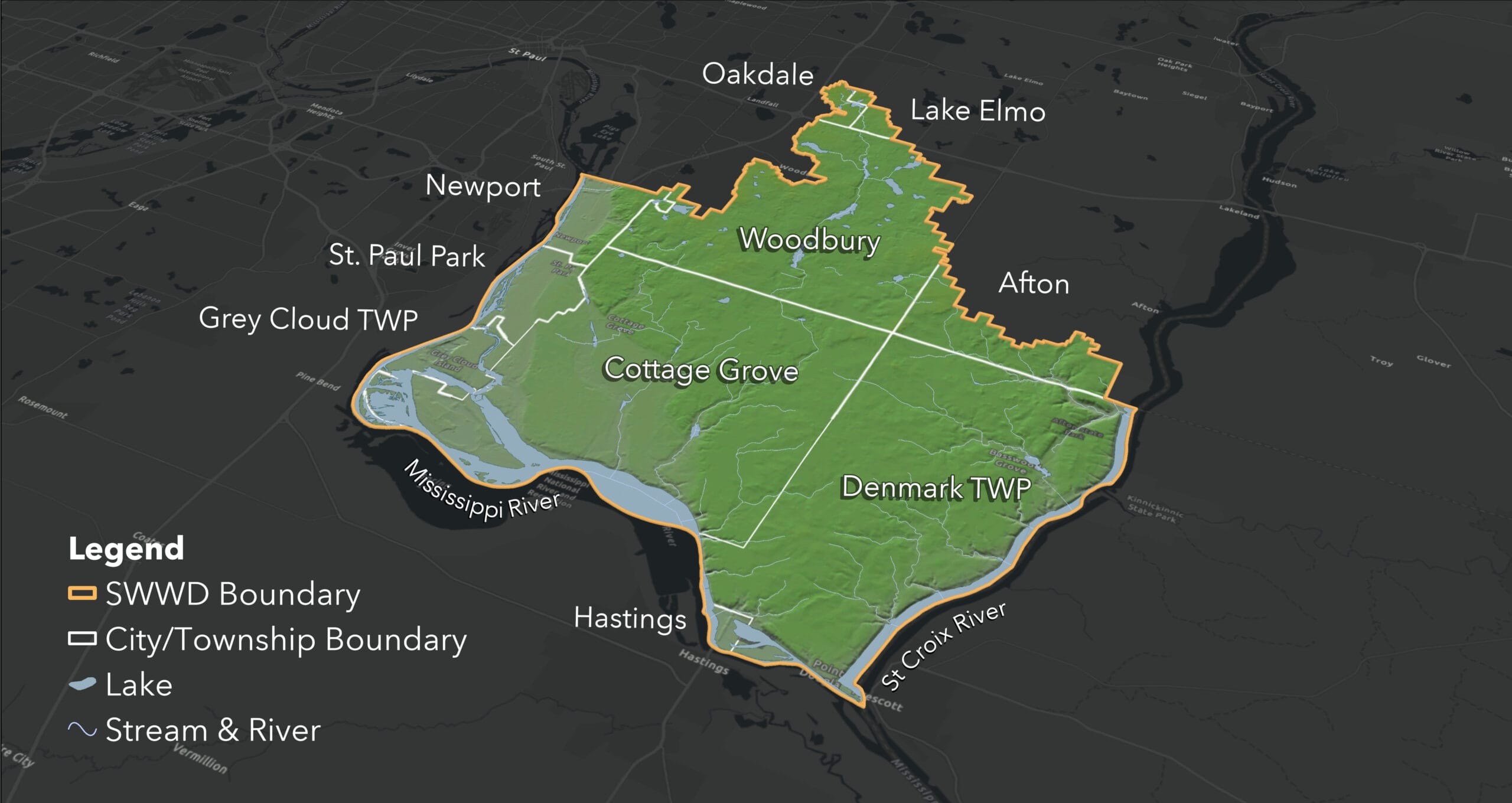
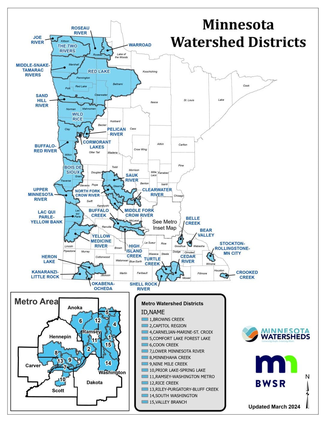
The South Washington Watershed District (SWWD) is located entirely in Washington County; however is organizationally separate from the county. SWWD contains portions of ten cities and townships: Afton, Cottage Grove, Denmark Township, Grey Cloud Island Township, Hastings, Lake Elmo, Newport, Oakdale, St. Paul Park, and Woodbury.
Mission Statement
“To manage water and related resources of the District in cooperation with our residents and communities”
Our History
The Cottage Grove Ravine Watershed Management Organization (WMO) was formed in 1984 to manage the resources of the watershed. This WMO was based on a joint powers agreement among the five cities in the watershed. The WMO was later disbanded, and in 1993, the Cottage Grove Ravine Watershed District was formed as the 42nd watershed district in Minnesota. In 1995, the watershed district changed its name to the South Washington Watershed District (SWWD).
In April 2003, the SWWD petitioned the Minnesota Board of Water and Soil Resources to enlarge the boundary and include the East Mississippi Water Management Organization. The East Mississippi Water Management Organization included all or portions of Grey Cloud Island Township, Cottage Grove, Woodbury, St. Paul Park, and Newport. The enlargement was completed as part of the recommendations from the 1999 Washington County Water Governance Study. The enlargement petition was approved on May 28, 2003, by the Minnesota Board of Water and Soil Resources (BWSR).
In 2009, Washington County petitioned BWSR to enlarge SWWD’s boundary to include 4 of the 5 subwatersheds of the former Lower St. Croix Watershed Management Organization (LSCWMO), which had dissolved. BWSR approved the petition to enlarge SWWD’s boundary. Still, later in 2009, BWSR contracted SWWD’s boundary by moving 3 of the new subwatersheds to the Valley Branch Watershed District in approving a citizen petition. In May 2010, the SWWD petitioned BWSR in response to a mediated agreement, with the support of all affected local municipalities and organizations, to again enlarge the boundary to include the 3 additional subwatersheds from the former LSCWMO, which lie in the Lower St. Croix River Basin. The enlargement petition was approved in September 2010 by BWSR.
In May 2010, the SWWD petitioned BWSR in response to a mediated agreement, with the support of all affected local municipalities and organizations, to again enlarge the boundary to include the 3 additional subwatersheds from the former LSCWMO, which lie in the Lower St. Croix River Basin. The enlargement petition was approved in September 2010 by BWSR.
Frequently Asked Watershed Questions
What is a Watershed?
A watershed is all the land area that drains to a specific water resource, such as a lake or stream. Watersheds range in size from a few square miles to an entire continent. As water runs downhill it carries materials, like sediment and pollution, into streams, lakes, and groundwater. Watersheds provide water that we drink, the lakes we recreate on, and the water that supports the environment.
Hydrologic watersheds are large and small. Larger watersheds, like the Mississippi River watershed, span the length of the United States. Within large watersheds, are smaller watersheds or subwatersheds.
What is a Watershed District?
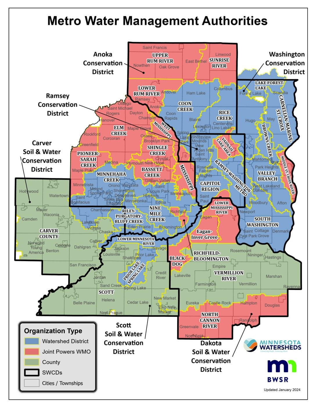
Water does not follow political boundaries like cities and counties. But watersheds create hydrologic boundaries, which are managed by Watershed Districts. Watershed Districts are a form of local government, established in state statue 103D. Watershed Districts are responsible for managing the water resources within its boundaries.
What do Watershed Districts do?
Watershed Districts are responsible for water related natural resources.
- Create rules to regulate, conserve, and control the use of water resources within the boundary.
- Work with other local government, private, and public corporations to enact water resource management projects.
- Hire staff and contract with other professional consultants
- Assess properties for benefits received and levy taxes to finance district administration.
- Accept public and private grant funds, including debts.
- Obtain property needed for projects.
- Acquire, build, and operate drainage systems, dams, dikes, reservoirs, and water supply systems.
- Enter lands within and without the district boundary for survey and gather information.
The South Washington Watershed District does not manage water for consumption. Questions and information about drinking water should be directed to your city or county of residence.